Geographic information from the sky
SERTIT leverages space to serve the Earth by producing geographic information from satellite, aerial, and drone imagery.
Page contents
The platform
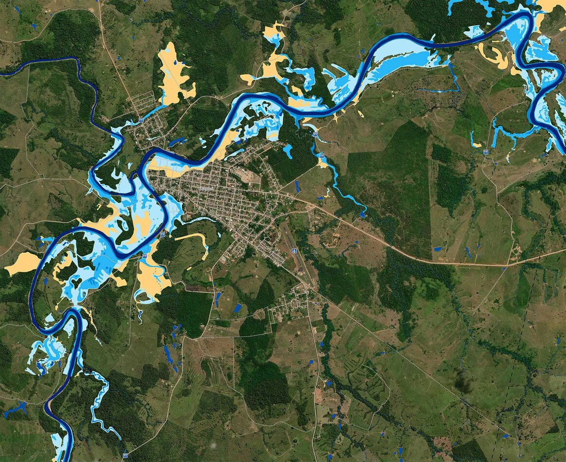
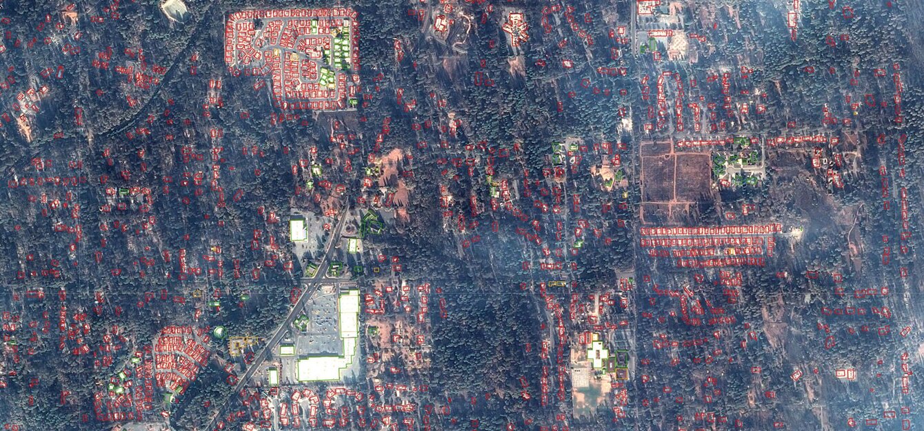
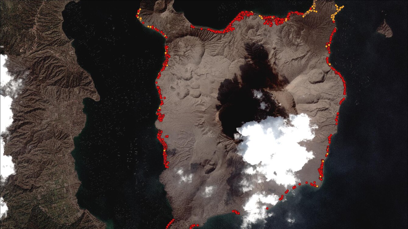
The Regional Service for Image Processing and Remote Sensing (SERTIT) puts space-based observation at the service of the Earth, delivering rapid-mapping capabilities for emergency situations. Unique in France for its fully operational 24/7/365 service model and ISO 9001 certification, SERTIT provides essential geospatial information to civil-protection agencies during major disasters.
Beyond emergency response, it supports broader societal needs by offering solutions for sustainable development, including land-use planning, natural-resource and environmental management, and risk assessment.
Photo gallery
Expertise and resources
ServicesTo collect and process geographic data
- Rapid mapping of natural and human-made disasters
- Risk assessment and reconstruction
- Water resource monitoring
- Forest resource monitoring
- Flood modeling
- Land-use planning
- Security and defense
- Training
![[Translate to English:] Logo du SERTIT](/websites/_processed_/e/5/csm_SERTIT_c50c8cb049.jpg)
![[Translate to English:] Images plateforme SERTIT](/websites/_processed_/6/b/csm_Cartographie_rapide1_37dfce43e6.jpg)
![[Translate to English:] Images plateforme SERTIT](/websites/_processed_/5/a/csm_Carto_Scolytes_2020-light_d00127875e.jpg)
![[Translate to English:] Images plateforme SERTIT](/websites/_processed_/4/5/csm_Eau1_2ff0f2c949.jpg)
![[Translate to English:] Images plateforme SERTIT](/websites/_processed_/c/d/csm_Produits_Incendies1_aa3e47ca6a.jpg)
![[Translate to English:] Images plateforme SERTIT](/websites/_processed_/8/c/csm_Produits_Inondations1-light_410605058a.jpg)
![<strong>Risque et Reconstruction à St-Martin - Image Pléaides © AirbusDS, CNES</strong> [Translate to English:] Images plateforme SERTIT](/websites/_processed_/0/5/csm_Risque__Reconstruction-banner-light_bc0caf3e11.jpg)
![[Translate to English:] Images plateforme SERTIT](/websites/_processed_/3/6/csm_SERTIT-RMS_VisiteHCERES20221019-9_8c92d04445.jpeg)
![[Translate to English:] Images plateforme SERTIT](/websites/_processed_/8/a/csm_sertit_reunion_61x91_ocs_pld20170807_strasbourg_pres-light_0563d9ba4c.jpg)
![<em>Modélisation de la profondeur des eaux suite aux inondations du Rio Grande do Sul en 2024</em> [Translate to English:] Inondations](/websites/_processed_/e/b/csm_Inondations_9211ee13a5.jpg)


